Geographical location of Da Lat
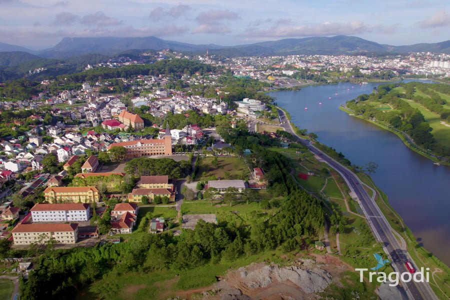
Da Lat is located on the Lam Vien plateau, in the North of Lam Dong province, at an altitude of 1,500 m above sea level. To the North of Da Lat city is Lac Duong district, to the East and Southeast is Don Duong district, while to the West and Southwest, the city borders Lam Ha and Duc Trong districts. Da Lat has an area of over 400 km², surrounded by high mountain peaks and continuous mountain ranges. Da Lat is about 300 km West-Southwest of Ho Chi Minh City, with a convenient location and transportation system for expanding exchanges with the economic centers of the South and the Central Coast.
Weather and climate of Da Lat
Due to the influence of altitude and the pine forest vegetation, Da Lat’s weather has many characteristics of a temperate region, cool all year round. The city of Da Lat has a low temperature. The average temperature ranges from 18 to 21°C, the highest temperature has never exceeded 30°C and the lowest is not below 5°C. Da Lat has two distinct seasons: the rainy season and the dry season.
Dry season: from November to April, coinciding with the Northeast monsoon season, the weather is generally warm, sunny, few clouds, no rain, low temperature at night. Occasionally there will be rain in the afternoon, sometimes hail.
Rainy season: from May to October, coinciding with the Southwest monsoon season, there is often heavy or prolonged rain. The average annual rainfall is 1562 mm and the humidity is 82%.
Da Lat never has storms, only strong winds due to the influence of storms from the sea blowing in because the eastern slope has no mountains to shield.
With its excellent geographical location, weather, and climate, Da Lat is an ideal destination for tourism. You can visit Da Lat at any time of the year, depending on your preferences and purposes. Da Lat has many beautiful natural landscapes, unique architecture, diverse culture, and rich cuisine.


